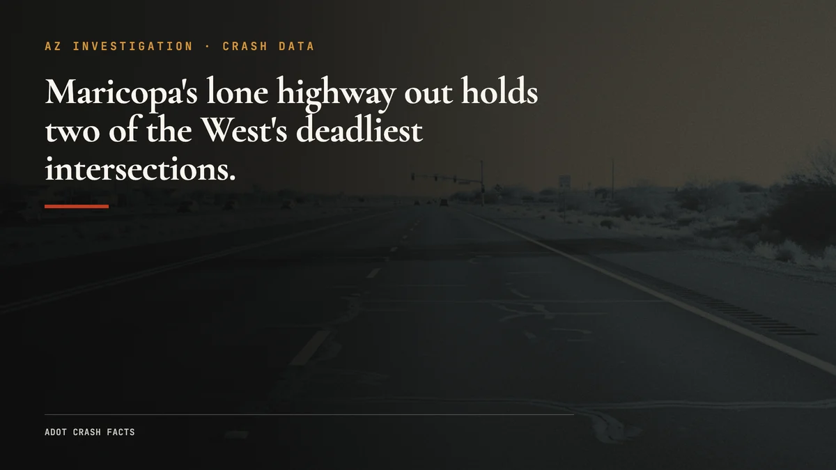
SR-347 is the road Maricopa can’t avoid. If you live in the city and work anywhere in metro Phoenix, this two-lane highway is your way to the freeway and back, twice a day, every day.
Two lanes heading north. Two heading south. No median barrier. Posted speed 65 mph. Semis mixed in with sedans. Everyone trying to reach I-10 before the merge backs up. That mix, on a road built for rural volumes, is what shows up in the crash record.
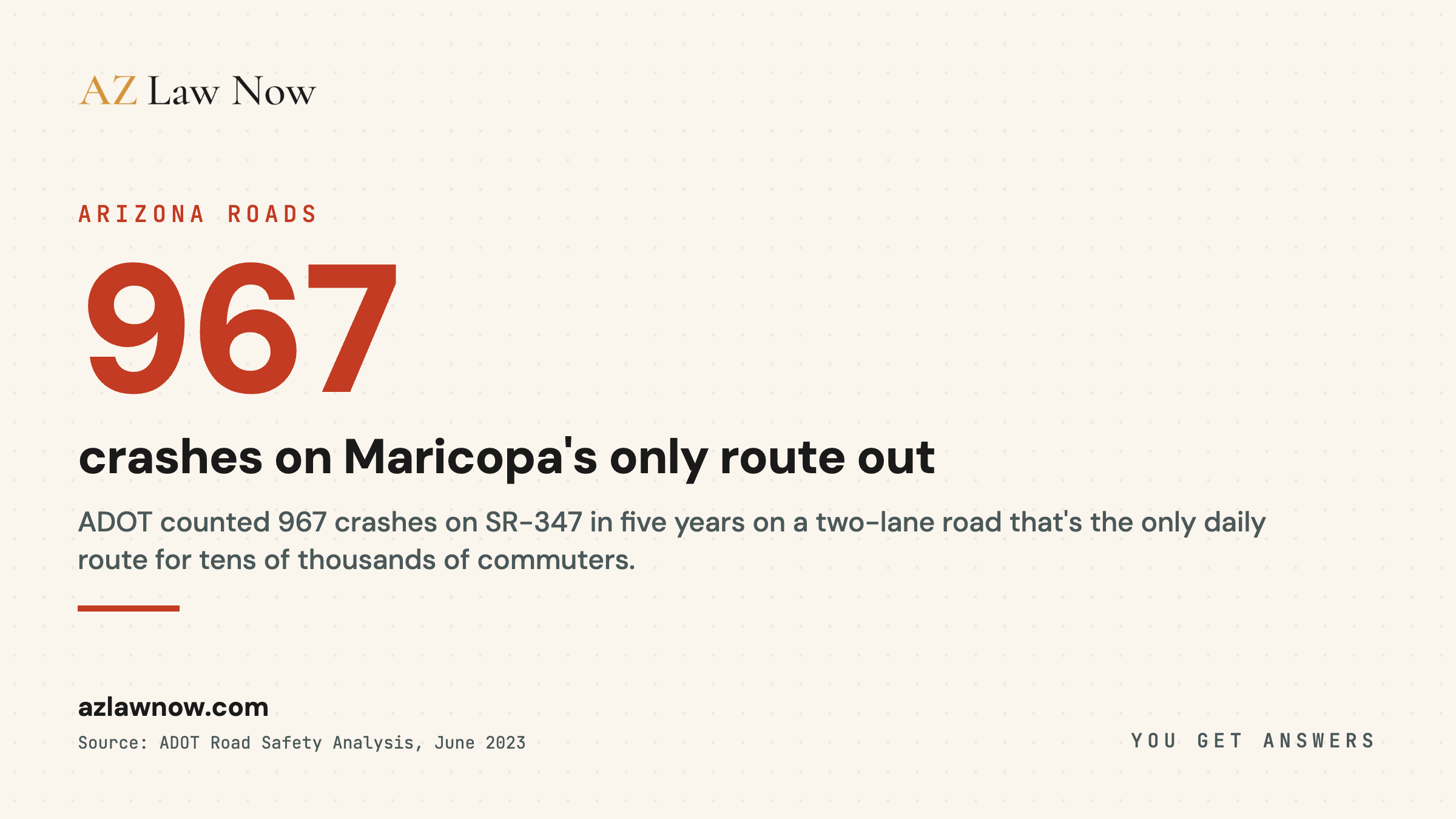
ADOT’s own road safety analysis counted 967 crashes on this corridor over five years. The numbers describe a road that was never built for what it’s being asked to do, and the state has finally started building the fix.
The Road
SR-347 runs roughly 20 miles between the City of Maricopa and Interstate 10 near the Maricopa Road interchange. It’s the primary connection between Maricopa City and the Phoenix metropolitan area. If you live in Maricopa and work anywhere in metro Phoenix, you’re probably on this road twice a day.
The highway is a two-lane undivided road for most of its length, with a painted center line and no median barrier separating opposing traffic. ADOT’s project documentation describes exactly the condition that drivers feel every morning: a corridor carrying commuter volumes on a rural two-lane design.
The posted speed limit is 65 mph along the main corridor. A 2023 ADOT speed study looked at the intersection zones posted at 55 mph and recommended raising several of them to 65 mph, a sign of how the road’s design and its actual use have drifted apart.
There are no continuous passing lanes for most of the route. If you get behind a truck, you stay behind it until a rare passing zone, or until someone gets impatient enough to cross the center line. On a two-lane road with no barrier, that impatience is where head-on risk comes from.
Five Years of Crash Data
The clearest public accounting of this corridor comes from ADOT itself. In June 2023, ADOT presented a road safety analysis covering the five years from July 2017 through June 2022.
That’s an average of roughly 193 crashes per year over the five-year window, on a corridor that is mostly two lanes. The same analysis counted 15 fatal crashes over the period.
The toll isn’t spread evenly. An independent analysis of NHTSA data ranked the SR-347 intersection at Riggs Road fourth statewide for collisions at a signalized intersection. The Maricopa Road intersection recorded five fatal crashes between 2004 and 2022. Two-thirds of collisions on the corridor have been rear-end crashes, the analysis found, with crash counts peaking around the morning and afternoon commute hours.
ADOT classifies SR-347 as a rural principal arterial. The route-level crash totals broken out by year, segment, and crash type live in ADOT’s Arizona Crash Information System, which isn’t searchable through a public web page. A full milepost-by-milepost breakdown for the corridor requires a public records request to ADOT. Until that data is in hand, this report stays with what the public record already proves: a corridor with close to 1,000 crashes in five years and a fatal-crash pattern concentrated at a handful of intersections.
A Record Year, Then a Decline
The corridor’s trend tracks the county around it. Pinal County set a crash record in 2022, the same year Arizona reached a statewide high for traffic deaths. The following year brought a meaningful decline. ADOT data compiled through public records and published on a community tracking site shows one SR-347 fatality recorded in 2023, down from a peak of nine in 2022.
One year isn’t a trend, and the structural conditions that produced 967 crashes haven’t changed. But the 2023 drop is consistent with the broader statewide pullback from the 2022 record, and it’s the most recent year-level figure the public record supports.
The Commercial Vehicle Factor
SR-347 isn’t just a commuter road. It’s a freight route.
Distribution and logistics operations in the Maricopa and Casa Grande areas generate commercial truck traffic that uses SR-347 to reach I-10. That commercial share of the traffic mix is consistent with the warehouse and distribution growth across the region.
The physics are why trucks matter so much on a road like this. A loaded semi weighing up to 80,000 pounds meeting a passenger car head-on, with no median barrier between them, produces an outcome that almost always kills someone in the smaller vehicle. On a two-lane corridor where opposing traffic is separated only by paint, every oncoming truck is a potential fatality. That is the central reason a rural two-lane design is the wrong fit for SR-347’s traffic.
The Commuter Problem
Here’s the context that makes SR-347 different from other rural highways with crash problems.
The City of Maricopa counted 58,125 residents in the 2020 Census. The U.S. Census Bureau’s July 2024 estimate puts the city at roughly 67,163, growth of about 16% in four years. Other regional estimates run higher, but every source agrees the city is growing fast.
Maricopa doesn’t have a large employment base. Most jobs that Maricopa residents hold are in the Phoenix metro area, 35 to 50 miles north. That makes SR-347 to I-10 the daily route for a large share of the city’s workers. It’s the fastest route. It’s often the only practical route.
The road handles commuter-level volumes on a rural two-lane design. That mismatch, more residents and more daily trips funneled onto a corridor built for far less, is the core of the safety problem and the reason ADOT moved to widen it.
The comparison to I-10 through Buckeye and Goodyear is instructive. I covered the I-10 corridor data in a separate investigation. I-10 is a multi-lane divided interstate with median barriers, wide shoulders, and controlled access. SR-347 is a two-lane road with driveways, at-grade intersections, and oncoming traffic separated by paint. Mile for mile, the two roads aren’t in the same risk category.
What ADOT Is Doing About It
For years, the SR-347 widening was a study and a wish. That changed.
ADOT completed a corridor study that recommended widening SR-347 to a four-lane divided highway. ADOT then selected Sundt Construction and finalized a preconstruction contract in February 2026. ADOT’s own project page states the work is “scheduled to begin this summer and will take approximately three and a half years to complete.”
The program is split into two segments. The Pinal County segment is funded in FY27, and the Maricopa County segment, from I-10 to Riggs Road, is funded in FY31, with local officials pushing to advance that timeline. The full $396 million is the programmed total, well above the earlier $280 million estimate the project carried in its study phase.
So the long-term fix is no longer hypothetical. It’s under construction. But three and a half years of building means three and a half more years of commuter-volume traffic on the existing two-lane road, much of it through active work zones, before the widened highway opens.
The Alternatives That Don’t Exist
Part of what makes SR-347 dangerous is that there’s no alternative.
If I-10 through Buckeye has a wreck, commuters can take surface streets, reroute through Goodyear, or wait it out. Multiple parallel routes exist. Inconvenient, but possible.
If SR-347 is blocked, Maricopa residents have one practical option: State Route 238 west to SR-85, then north to I-10, a detour that adds substantial time each way. During the morning commute, a crash on SR-347 can strand thousands of vehicles with no quick way around.
The lack of alternatives concentrates risk. Every Maricopa commuter uses the same road. One crash affects everyone. That single-corridor dependence is exactly what the widening, and the interim safety work, are meant to relieve.
What You Can Do If You Crash on SR-347
SR-347 crashes have specific complicating factors that make the first hours after a crash especially important.
Cell coverage can be inconsistent on the rural middle segments of the corridor. If you can’t get a call through to 911, try texting your location. You can also flag another driver. This road is busy enough that someone will stop within minutes during daylight hours.
Move off the roadway if you can. SR-347’s shoulders are narrow. A disabled vehicle on the shoulder of a 65-mph two-lane road is a secondary crash risk. If your vehicle is drivable, pull as far off the travel lane as possible. Turn on hazard lights. If it’s dark, use your phone’s flashlight to make yourself visible.
Get medical attention within 24 hours. The same advice applies here as it does for I-10. Adrenaline masks pain. Soft tissue injuries show up days later. The medical record connecting your treatment to the crash date is critical for any insurance claim or legal action.
Document the scene. SR-347 doesn’t have traffic cameras. The responding agency (Arizona DPS for the highway segments, Maricopa PD for city segments, Ak-Chin PD for tribal land) will write a crash report, but your photos, your GPS timestamps, and your notes add detail that the official report might miss.
If the crash involved a commercial vehicle, the stakes escalate. Trucking companies have response teams. The driver’s electronic logging device, the truck’s event data recorder, and the carrier’s maintenance records all contain evidence that can disappear if nobody requests preservation. An attorney who handles commercial vehicle crashes knows to send a spoliation letter the same day.
AZ Law Now handles SR-347 crash cases. The team knows this corridor and works with the agencies that respond to crashes on this road. Drivers and families hurt in a crash on SR-347 can reach the firm at (602) 654-0202 or through the contact form. Intake is confidential. Representation is on contingency.
What Happens Next
The widening is the long-term fix, and it’s finally moving dirt. But three and a half years of construction means the existing two-lane road, now with active work zones, stays in service through the build. Crash risk on a corridor like this often climbs during construction before the finished highway brings it down.
We’ll update this report as construction milestones land and as ADOT publishes new annual crash data for the corridor. The route-level breakdown by segment and crash type sits in ADOT’s crash system behind a records request.
If you have information about crashes on SR-347, or if you’re a Maricopa resident with observations about conditions on this road, reach out. This is a corridor we’re going to keep tracking.
Related Coverage
For the legal and process context, see Ron DeBrigida’s guide to Arizona car crash law, Stephanie Ramirez’s car crash first 48 hours, the car crashes practice overview.
For Maricopa-specific case pages: Maricopa car accident lawyer covers SR-347 crash patterns, Pinal County jurisdiction, and government entity notice deadlines. Maricopa motorcycle accident lawyer covers the corridor-specific risks for riders on this road.
Frequently asked questions
How many crashes happen on SR-347?
Why is SR-347 so dangerous?
Is ADOT planning to widen SR-347?
What should I do if I'm in a crash on SR-347?
Are there a lot of trucks on SR-347?
Is Arizona an at-fault state for car accidents?
Who pays when you're hit by an uninsured driver in Arizona?
Sources & references
- Arizona Department of Transportation. (2026). SR-347 Improvement Project. Retrieved June 2026, from https://azdot.gov/sr347
- Arizona Department of Transportation. (2026). SR-347 Corridor Widening (I-10 to City of Maricopa) https://azdot.gov/projects/central-district-projects/sr-347-corridor-widening-i-10-city-maricopa
- InMaricopa. (2026). SR-347 widening construction timeline https://inmaricopa.com/347-construction-timeline/
- InMaricopa. (2023). ADOT: SR 347 the site of nearly 1,000 crashes from 2017-22 https://www.inmaricopa.com/adot-347-the-site-of-nearly-1000-crashes-from-2017-22/
- InMaricopa. (2024). Study: SR 347 intersections among most dangerous in the western U.S https://inmaricopa.com/study-sr-347-intersections-among-most-dangerous-in-western-u-s/
- 347 Facts. (2026). State Route 347 crash and project data (ADOT public records) https://347facts.com/#about
- Pinal Central. (2024). After record 2022, Pinal's crash-related fatalities down in 2023 https://www.pinalcentral.com/casa_grande_dispatch/area_news/after-record-2022-pinals-crash-related-fatalities-down-in-2023/article_436f073c-43d0-11ef-8f68-5b1c088082cc.html
- U.S. Census Bureau. (2025). QuickFacts: Maricopa city, Arizona https://www.census.gov/quickfacts/fact/table/maricopacityarizona/PST040224
- Arizona Department of Transportation. (2025). Arizona Motor Vehicle Crash Facts https://azdot.gov/planning/traffic-safety/arizona-motor-vehicle-crash-facts
- Arizona Department of Transportation. (2025). Arizona Crash Information System (route-level data available by public records request) https://azdot.gov/tags/crash-data
- Arizona State Legislature. ARS 12-2505: Comparative negligence https://www.azleg.gov/ars/12/02505.htm
- Arizona State Legislature. ARS 12-558: Uninsured motorist recovery https://www.azleg.gov/ars/12/00558.htm