
The Finding
Loop 101 runs about 61 miles around the Phoenix metro. It starts at I-10 in Tolleson, runs north through west Phoenix, Glendale and Peoria to I-17, turns east across north Phoenix to Scottsdale, then south through Scottsdale, Tempe and Chandler.
From 2015 to 2025, the Arizona Department of Transportation recorded 200 people killed in crashes on the freeway and its ramps, and 25,651 hurt.
In the last five years, more than half of those deaths came on one side of the loop.
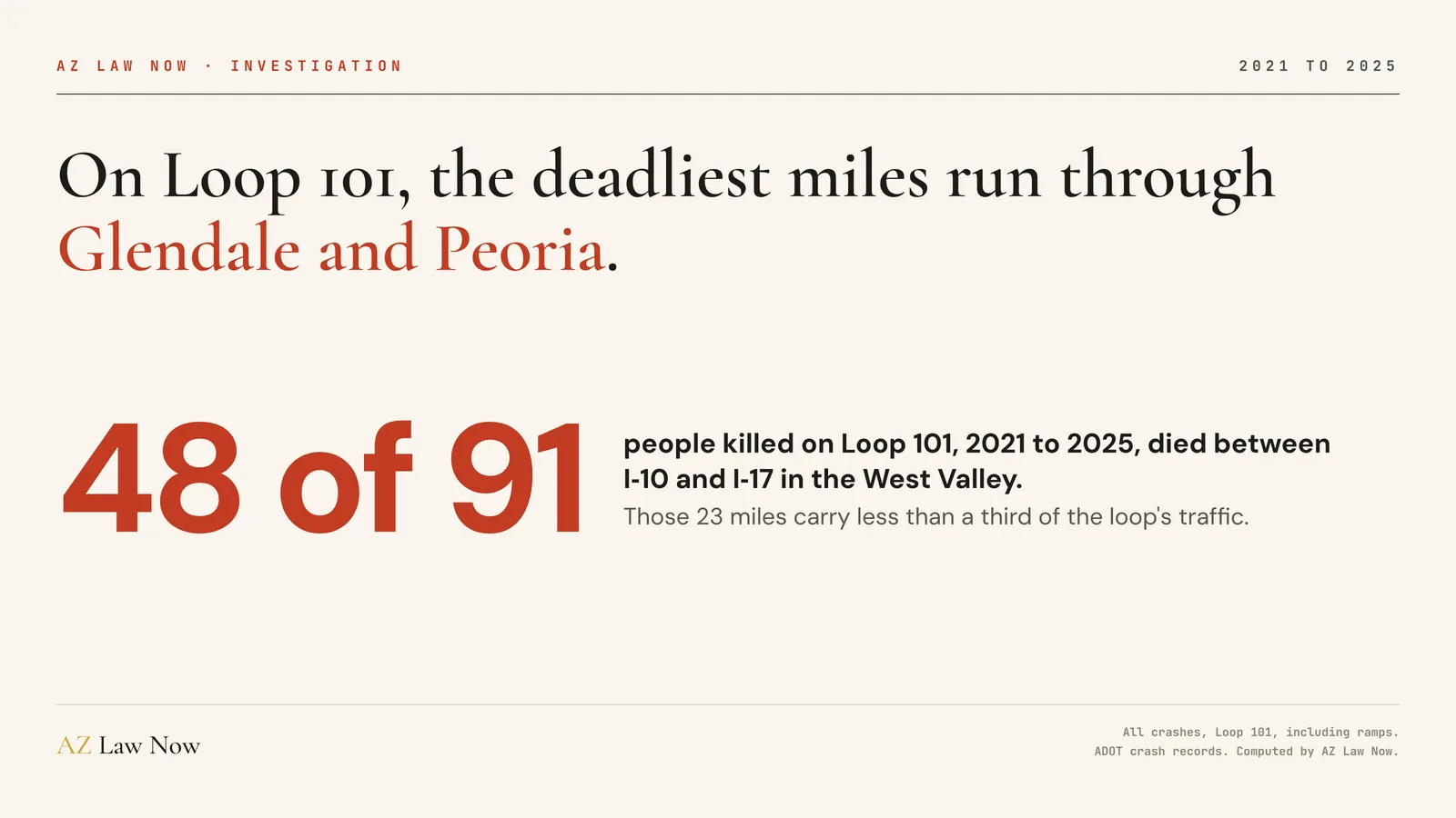
That’s the Agua Fria Freeway, the stretch from I-10 north past Camelback Road, Northern Avenue, Grand Avenue and Bell Road to I-17. It’s about 37% of the loop’s length and carries about 31% of its traffic. Since 2021, it has had more deaths than the other 39 miles combined.
How I Counted
The crash records come from ADOT’s own crash database, which AZ Law Now obtained through a public records request. They cover every reported crash on a state highway from 2015 through 2025, at every level of injury.
I kept crashes on the Loop 101 mainline, its ramps and its frontage roads. Each mainline crash went onto the map by its ADOT milepost. Each ramp crash went to the interchange it belongs to.
To check the deaths, I matched them against the National Highway Traffic Safety Administration’s Fatality Analysis Reporting System, the federal census of fatal crashes. For 2015 to 2024 it counts 193 deaths on Loop 101. ADOT’s records count 184 over the same years. Both put 80 of them on the West Valley side.
Some stretches carry far more traffic than others, so I measured deaths against vehicle miles traveled. Those come from ADOT’s 2024 traffic counts, applied to 2021 through 2025, so treat each rate as an estimate.
About 2.4 Times the Death Rate
I split Loop 101 into four stretches at the freeways that divide it: I-17, Scottsdale Road and Loop 202. From 2021 to 2025, the West Valley stretch ran about 0.85 deaths per 100 million vehicle miles.
The rest of Loop 101 ran about 0.35. Scottsdale ran 0.37, north Phoenix 0.35, and Tempe and Chandler 0.30.

It isn’t one bad interchange. Over 2015 to 2025, every part of the West Valley side ran a higher death rate than the rest of the loop. The worst piece was Bell Road to 67th Avenue, at the Glendale and Peoria line, with 15 deaths in 3.5 miles.
Counting deaths and suspected serious injuries together, the West Valley side ran about 2.75 per 100 million vehicle miles from 2021 to 2025. The rest of the loop ran about 1.6.
The Gap Opened After 2020
The West Valley side was already the deadlier part of Loop 101 a decade ago, but not by much.
From 2015 to 2020, ADOT recorded 42 deaths there and 67 on the rest of the loop. From 2021 to 2025, it recorded 48 on the West Valley side and 43 everywhere else. Deaths rose on the 23 western miles while they fell on the other 39.

The other driver’s insurer starts building its version of the crash right away. You should have someone building yours.
Call (602) 654-0202, 24/7, or get your free case review. No fee unless we recover.
What the Fatal Crashes Look Like
The 83 fatal crashes on the West Valley side from 2015 to 2025 don’t share one cause. Thirty-five involved a single vehicle. Eighteen were rear-end crashes. Seven were head-on crashes, which on a divided freeway usually means a driver going the wrong way. Forty-seven happened after dark.
Nineteen happened on ramps or frontage roads, not the freeway itself.
The federal fatal crash records add one more pattern. From 2015 to 2024, a driver who had been drinking was involved in 24 of 75 fatal crashes on the West Valley side, about 1 in 3. On the rest of Loop 101 it was 22 of 109, about 1 in 5.
Nineteen of the people killed on Loop 101 in those years were pedestrians, 9 of them on the West Valley side.
Where People Get Hurt: Tempe
Deaths and injuries don’t cluster in the same place. For injuries, the worst miles on Loop 101 are in Tempe.
From 2021 to 2025, the 2.5 miles from Rio Salado Parkway to Southern Avenue, around the US 60 interchange, logged 3,787 crashes and 1,808 people hurt. That’s about 15% of everyone hurt on Loop 101, on a stretch that carries about 5% of its traffic.
The interchanges do much of the damage. The US 60 interchange logged 349 ramp crashes in those five years, more than any other on the loop. Bell Road in Glendale and Peoria was next with 340, then I-17 with 317.
Across the whole loop, crashes hurt 11,641 people from 2021 to 2025.
Trucks Are a Smaller Part of the Story
Loop 101 is mostly a commuter road. ADOT’s 2024 counts put combination trucks at about 2.8% of its traffic, about half their share on Loop 303.
From 2021 to 2025, a medium or heavy truck was involved in 2,375 crashes, about 9% of the total. Those crashes hurt 636 people, 475 of them outside the truck, and killed 7. A semi was involved in about 1 in 110 crashes.
When a truck is involved, the injuries tend to fall on the people in the smaller vehicle. But most Loop 101 deaths come from crashes between passenger vehicles, or from a single vehicle leaving the road.
What This Means
On Loop 101, the people hurt and killed are mostly commuters and local drivers. Of the 193 people killed in the federal fatal crash records for 2015 to 2024, 146 were drivers and 27 were passengers.
A freeway crash can involve more than one at-fault party. A distracted or impaired driver, a bar that kept serving them, a work-zone contractor, or the road itself may each matter. The police report, freeway camera video and vehicle data each hold part of the answer.
If you or someone in your family was hurt on Loop 101, talk to a lawyer before you give a recorded statement to anyone’s insurer. Our Phoenix car crash lawyers handle freeway crashes across the Valley, from Glendale and Peoria to Scottsdale and Tempe, and the first conversation is free.
For the last five years, the 23 miles from I-10 to I-17 have been the deadliest part of Loop 101, and the gap with the rest of the loop is wider than it was before 2021.
Freeway camera video, vehicle data, and 911 recordings can be erased or overwritten if no one asks for them in time. We move quickly to lock that evidence down.
Call (602) 654-0202 now or start your free case review. No fee unless we recover.
Related Coverage
Farther west, see where a third of Loop 303’s crash deaths came on 3 miles near Glendale Avenue. Head-on crashes like the ones on the Agua Fria Freeway are covered in our wrong-way crash investigation, and drinking drivers in our Phoenix DUI crash data. For surface streets, see the West Valley’s most dangerous intersections.
If a truck was involved, see our Phoenix truck crash lawyers and how I-10 truck crash deaths rose 76% between Phoenix and Tucson.
Frequently asked questions
How many people have died in crashes on Loop 101?
What is the most dangerous part of Loop 101?
Is Loop 101 getting more dangerous on the west side?
Where are the most injury crashes on Loop 101?
How often are trucks involved in Loop 101 crashes?
How did AZ Law Now count Loop 101 crashes?
What should I do after a crash on Loop 101?
Sources & references
- Arizona Department of Transportation. Arizona Crash Information System (ACIS) crash records, 2015 to 2025. Obtained by AZ Law Now through a public records request, October 2026.
- National Highway Traffic Safety Administration. (2025). Fatality Analysis Reporting System (FARS), 2015 to 2024. Retrieved November 12, 2026, from https://www.nhtsa.gov/research-data/fatality-analysis-reporting-system-fars
- Arizona Department of Transportation. (2025). AADT sections, 2024: traffic and truck traffic by milepost for SR 101. Retrieved November 12, 2026, from https://services6.arcgis.com/clPWQMwZfdWn4MQZ/ArcGIS/rest/services/AADT_Spreadsheet_Spatial/FeatureServer
- Arizona State Legislature. ARS 12-542: Limitation of Actions, Personal Injury. Retrieved November 12, 2026, from https://www.azleg.gov/ars/12/00542.htm
- Arizona State Legislature. ARS 12-611: Wrongful Death Action. Retrieved November 12, 2026, from https://www.azleg.gov/ars/12/00611.htm
- Arizona State Legislature. ARS 12-821.01: Notice of Claim Against a Public Entity. Retrieved November 12, 2026, from https://www.azleg.gov/ars/12/00821-01.htm